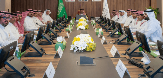
The National Committee for Geographical Names held its 19th meeting, chaired by the Committee Chairman, Dr. Eng. Muhammad bin Yahya Al-Sayel, President of the General Authority for Surveying and Geospatial Information, with the participation of Committee members from relevant agencies. During the meeting, the committee reviewed a number of items on its agenda, including requests regarding geographic names received from the Northern Border regions, Al-Jawf, Tabuk, Al-Qassim, and Asir, in accordance with its mandated responsibilities and approved national standards.
The committee discussed coordination and harmonization efforts with the Royal Commission for Al-Ula, the Ministry of Municipalities and Housing, and the Ministry of Interior, with a view to enhancing the standardization of references and the integration of geographic name databases among government agencies.
The committee recommended adopting the geographic names database maintained by the General Authority for Surveying and Geospatial Information as an approved national reference, and as the basis for all related databases within government agencies, thereby supporting the unification of the national reference system for geographic names and enhancing the governance of
It should be noted that the National Committee for Geographic Names is chaired by the President of the General Authority for Surveying and Geospatial Information, which also serves as its secretariat. The committee is responsible for reviewing geographic names and taking the necessary actions regarding them in accordance with national standards, thereby supporting the establishment of a reliable national database of geographic names.
Adoption of the «Geospatial» Database as a National Reference for Geographic Names
The National Committee for Geographical Names recommends standardizing government reference sources and adopting the Geospatial Authority’s database as the basis for improving governance, quality, and integration.