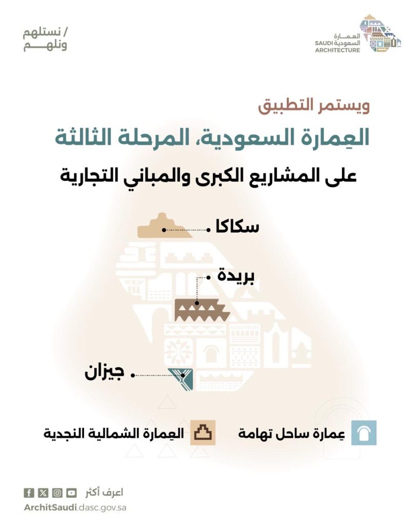

بدأت اليوم تنفيذ المرحلة الثالثة من الموجهات التصميمية للعمارة السعودية، لتشمل المشاريع الحكومية الكبرى والمباني التجارية في ثلاث مدن جديدة هي: جيزان، وسكاكا، وبريدة، وبذلك تنضم هذه المدن إلى كل من الدمام، والخبر، والقطيف، وحائل، والباحة، والمدينة المنورة، ونجران، وأبها، والطائف، والأحساء التي شملتها المرحلتان الأولى والثانية، ضمن إطار تطبيق خريطة العِمَارَة السعودية التي أطلقها صاحب السمو الملكي الأمير محمد بن سلمان بن عبدالعزيز آل سعود، ولي العهد رئيس مجلس الوزراء، رئيس اللجنة العليا للموجهات التصميمية للعمارة السعودية -حفظه الله- في شهر مارس الماضي.
وتجسد خريطة العِمَارَة السعودية جهود سموه -حفظه الله- في تعزيز الهوية العمرانية الوطنية، والارتقاء بجودة الحياة، وتحسين المشهد الحضري في مدن المملكة، بما ينسجم مع مستهدفات رؤية المملكة 2030م.
وتضمنت الخريطة 19 طرازًا معماريًا مستوحى من الخصائص الجغرافية والثقافية للمملكة، تم تحديدها بناءً على دراسات عمرانية وتاريخية تعكس إرث البناء المتوارث عبر الأجيال.
وتزامنًا مع إطلاق هذه الخريطة، جرى تأسيس أستديوهات تصميمية متخصصة تتبع هيئات التطوير والمكاتب الإستراتيجية وأمانات المناطق، لتقوم بدور محوري في دعم العملية التصميمية، ورفع جودة المخرجات العمرانية، وضمان مواءمتها للموجهات المعتمدة.
وتتضمن الطرز التي تشملها خريطة العِمَارَة السعودية العِمَارَة النجدية، والعِمَارَة النجدية الشمالية، وعِمَارَة ساحل تبوك، وعِمَارَة المدينة المنورة، وعِمَارَة ريف المدينة المنورة، والعِمَارَة الحجازية الساحلية، وعِمَارَة الطائف، وعِمَارَة جبال السروات، وعِمَارَة إصدار عسير، وعِمَارَة سفوح تهامة، وعِمَارَة ساحل تهامة، وعِمَارَة مرتفعات أبها، وعِمَارَة جزر فرسان، وعِمَارَة بيشة الصحراوية، وعِمَارَة نجران، وعِمَارَة واحات الأحساء، وعِمَارَة القطيف، وعِمَارَة الساحل الشرقي، والعِمَارَة النجدية الشرقية.